The Storm Prediction Center has issued tornado and severe thunderstorm watch alerts for specific U.S. states and has provided details on what each location can expect
The Storm Prediction Center (SPC) has placed central Oklahoma, and parts of north Texas under an Enhanced Risk for severe thunderstorms. This marks the regions as two of the most vulnerable areas in the nation for dangerous weather overnight. Kansas is also listed as an affected state
According to the outlook shared on March 3, 2025, thunderstorms were expected to erupt across portions of the southern and central Plains during the evening. This is set to increase in strength
Forecast models indicate the potential for a few tornadoes, along with damaging wind gusts and large hail, posing significant risks across multiple states
The threat stems from a mid-level short-wave troughing disturbance moving out of the Four Corners region, which was set to track eastward into the central and southern Plains. At the surface, a cold front advancing across the High Plains collides with a warm and moisture-rich air mass, creating the perfect environment for storm development.
This clash of air masses is already leading to atmospheric destabilization, particularly over western Oklahoma and western North Texas.
There, meteorologists are observing mixed-layer CAPE values around 1000 J/kg—a critical indicator of how much energy is available to fuel severe storms.
Initially, storms that formed on the evening of March 3 were expected to be slightly elevated, meaning large hail would likely be the first hazard to emerge. However, as the front continues its eastward march, storms are forecast to evolve into a more organized line, feeding off the increasingly unstable warm sector
This process, known as upscale growth, will allow storms to become more surface-based, unlocking a far more dangerous combination of damaging winds and embedded tornadoes.
The areas most at risk lie within the Enhanced Risk zone, which includes Oklahoma City, Norman, Wichita Falls, and Denton, where over 3.2 million people live. Surrounding this higher-risk core, a Slight Risk area extends to encompass cities such as Dallas, Fort Worth, Tulsa, and Wichita, where severe storms remain a distinct possibility
The broader Marginal Risk zone reaches even farther, covering parts of Kansas City, Omaha, and Topeka. This indicates that while the most dangerous weather is concentrated further south, strong storms could still develop across the central Plains.
In addition to the broad severe weather outlook issued for the Plains, the SPC has also placed portions of southwest Arkansas, southern and southeast Oklahoma, and central to northeast Texas under an active
Tornado Watches are different from Tornado Warnings, where a tornado has been either sighted or indicated by a weather radar. Additionally, a Tornado Emergency is issued when “a violent tornado has touched down in the watch area.”
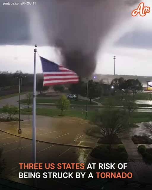
Social media users have already taken to platforms such as X to show the occurrence of these severe storms. One such post comes from a civilian in North Texas, where a tornado siren went off
This evolving and multi-faceted weather pattern underscores the volatile and rapidly changing conditions affecting much of the country this week.
From blizzards and fire weather to severe storms and flash floods, the central and southern United States are bracing for a high-impact stretch of weather, putting communities on high alert across multiple states.